Where Is Cape Blanco on the Oregon Coast, and What Is It Near?
 0
0
 0
0
Cape Blanco sits at the southwestern edge of Oregon, jutting into the Pacific farther west than any other point in the state. If you want to stand at the westernmost tip of Oregon, this is your destination. It is remote, wind-hammered, and strikingly beautiful, and understanding exactly where it falls on the map helps you plan a visit worth the drive.
The Exact Location of Cape Blanco
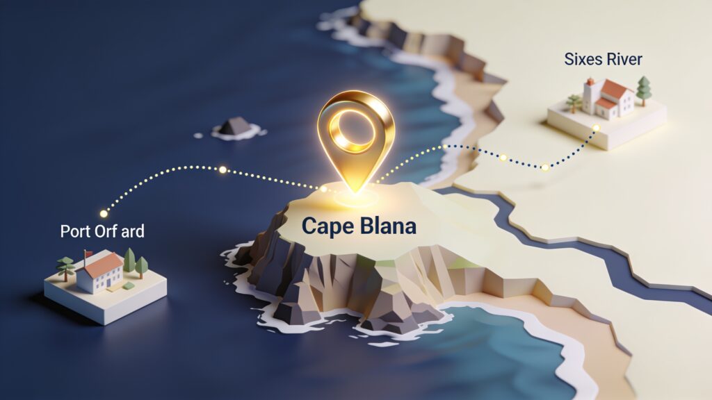
Cape Blanco is located in Curry County, Oregon, roughly 9 miles northwest of Port Orford. The coordinates place it at approximately 42.84 degrees north latitude and 124.56 degrees west longitude. On Oregon’s coast highway, US-101, the turnoff for Cape Blanco State Park appears between Port Orford to the south and Langlois to the north.
The cape itself extends into the Pacific, which is why it catches so much wind and fog. The lighthouse at Cape Blanco, built in 1870, sits at an elevation of 245 feet above sea level and remains the oldest continuously operating lighthouse in Oregon. That combination of elevation and western exposure means the beacon is visible from a long distance offshore.
Nearby Towns and Distances
Getting your bearings around Cape Blanco means knowing the distances to the towns you are most likely coming from. Here is a quick reference table.
| Town | Distance from Cape Blanco | Direction |
|---|---|---|
| Port Orford, OR | 9 miles | Southeast |
| Bandon, OR | 27 miles | North |
| Gold Beach, OR | 30 miles | South |
| Brookings, OR | 75 miles | South |
| Coos Bay, OR | 55 miles | North |
| Medford, OR | 100 miles | East (inland) |
| Eugene, OR | 200 miles | Northeast |
| Portland, OR | 310 miles | North |
Port Orford is the closest town with services. It is a small fishing community with motels, restaurants, and a grocery store. Bandon, about 27 miles north, is larger and has more lodging options if you plan to stay multiple nights and explore the region.
Getting There: The Routes That Work
Most visitors arrive via US-101. Coming from the north, take the Cape Blanco Highway west from US-101 at the town of Sixes, about 4 miles north of the main Port Orford intersection. The Cape Blanco Highway runs roughly 5 miles west to the state park entrance.
Coming from the south, pass through Port Orford heading north on US-101 until you reach the Cape Blanco Highway junction. The turnoff is well-signed.
If you are driving from inland Oregon, the two practical approaches are through Grants Pass on US-199 to Brookings and then north on US-101, or through Roseburg on OR-42 to Coos Bay and then south on US-101. Neither route is fast, but both are scenic. Budget about two hours from Grants Pass and two and a half hours from Roseburg.
What Is Cape Blanco Near? The Broader Regional Context
Cape Blanco sits within a stretch of the Oregon coast that packs a remarkable amount of variety into a short distance. Here is what you will find within about 30 miles in either direction.
To the south:
- Humbug Mountain State Park, 6 miles south in Port Orford, with a 1,756-foot peak you can hike directly from the beach
- Battle Rock Wayside in Port Orford, a dramatic sea stack right in town with real historical significance
- Prehistoric Gardens, a quirky roadside attraction about 12 miles south featuring life-size dinosaur sculptures in an old-growth forest
- Rogue River mouth and Rogue River Wilderness access at Gold Beach, 30 miles south
To the north:
- Floras Lake, about 12 miles north, a freshwater lake separated from the ocean by a narrow strip of land and a popular windsurfing spot
- Bandon, 27 miles north, known for its sea stack formations at Face Rock Wayside and a thriving local cheddar cheese industry
- Bullards Beach State Park just north of Bandon, with its own lighthouse, the Coquille River Lighthouse
Cape Blanco State Park itself has a campground with full hookup sites, tent sites, and several primitive horse camps. The Hughes House, a Victorian farmhouse on the park grounds, opens to visitors seasonally and tells the story of the Irish immigrant family that ranched this land in the late 1800s.
Why the Exact Location Matters for Visitors
Because Cape Blanco extends so far west, it takes weather punishment from a different angle than most Oregon coastal points. Wind speeds here are among the highest recorded on the coast. In winter and spring, storms roll in with force. In summer, the cape sits at the convergence of cold upwelling currents and afternoon sea breezes, meaning even July can feel raw.
That weather pattern directly shapes what you experience. The lighthouse tour is worth doing in any season, but if you want a comfortable walk along the beach or a relaxed picnic at the bluff’s edge, late summer through early fall is the most reliable window.
Key Takeaways
- Cape Blanco is Oregon’s westernmost point, located in Curry County about 9 miles northwest of Port Orford off US-101.
- The nearest services are in Port Orford. Bandon to the north and Gold Beach to the south offer more options for overnight stays.
- Access comes from the Cape Blanco Highway, a short spur west off US-101 near the town of Sixes.
- The surrounding 30-mile corridor holds Humbug Mountain, Floras Lake, Battle Rock, and the sea stacks of Bandon, making this one of the most varied coastal stretches in the Pacific Northwest.
- Plan for wind regardless of the season, and check the state park website for lighthouse tour schedules before you go.
If you are mapping out a southern Oregon coast trip, Cape Blanco belongs at the center of your itinerary. Put it as your anchor point and build the day’s driving around it. You will leave with a clear sense of why this headland has oriented sailors and settlers for over 150 years.